

 The
first requests for placing a light at this location were sent to Congress
in 1891. Congress took no action and the requests were made each year
until finally in 1901 $65,000 was granted for the building of the light.
Contracts were let for the fabrication of the caisson and the iron work
in 1902. Construction on site also began in 1902 with the erection of a
work pier and the building of a temporary caisson to ready the bottom in
the 22 feet of water to accept the iron caisson. On April 3 there
was an accident in which the wood pier collapsed and the three sectioned
iron caisson floated down the Bay in gale force winds. The caisson
was finally recovered 40 miles south off the Rappahannock River. It
was repaired and placed in its correct position on October 22 of 1903.
Work again continued and was going well when in February of 1904, heavy
ice again destroyed the pier and most of the construction equipment.
The caisson was not damaged this time. After rebuilding the pier and
reordering the equipment and parts that were lost, work continued and completed.
The
first requests for placing a light at this location were sent to Congress
in 1891. Congress took no action and the requests were made each year
until finally in 1901 $65,000 was granted for the building of the light.
Contracts were let for the fabrication of the caisson and the iron work
in 1902. Construction on site also began in 1902 with the erection of a
work pier and the building of a temporary caisson to ready the bottom in
the 22 feet of water to accept the iron caisson. On April 3 there
was an accident in which the wood pier collapsed and the three sectioned
iron caisson floated down the Bay in gale force winds. The caisson
was finally recovered 40 miles south off the Rappahannock River. It
was repaired and placed in its correct position on October 22 of 1903.
Work again continued and was going well when in February of 1904, heavy
ice again destroyed the pier and most of the construction equipment.
The caisson was not damaged this time. After rebuilding the pier and
reordering the equipment and parts that were lost, work continued and completed.
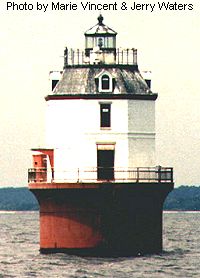
The light was first shown on April 24, 1905. It consisted of a fourth-order fresnel lens with a light burning kerosene. It had a flashing white and red light that alternated every 20 seconds. There was also a fog bell that was struck twice every 15 seconds. The light is 52 feet above the water. The lighthouse is octagon shaped with 11 foot sides. The first two stories are brick with the third floor, the watch room, of wood frame construction. There are four dormer windows on the watch level. The roof is painted black, the brick work is white and the iron caisson is painted brown. This light is very similar to the Sandy Point Shoal light that can be seen from Sandy Point State Park or from the Bay Bridge.
This light was fully automated in 1938 and the last Coast Guard personnel were removed in 1962. It is reported that the interior of this light is in very poor condition and in need of a lot of work.

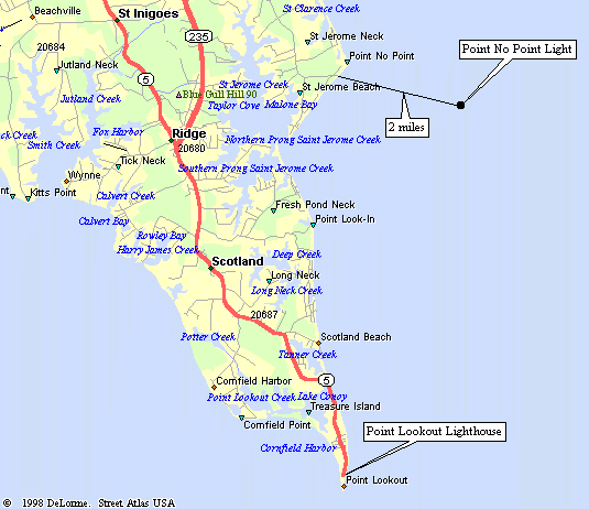
From the intersection of Interstate 95-495 with MD Route 5 south east of DC, go south on MD Route 5 (Branch Ave.) for 34 miles until the intersection with State Route 235 (Three Notch Road),
(At this point the main road becomes State Route 235 and State Route 5 makes a very sharp right turn.)
Continue on State Route 235 for 28 miles until you come to Saint Jeromes Neck Road on the left.
Turn left onto Saint Jeromes Neck Road and go 3.9 miles until you come to Eastey Road on the left. Eastey Road is a few 100 feet past Hawley Manor Road which will be on the right.
Turn left onto Eastey Road and go to the end of the road. Here there are two driveways, left and right. From here on, you are on your own. Good luck!
| Large Area Map | Detailed Local Map |
| Some of these maps are large in size and may take a minute or two to load. | |
 2001(c) Chesapeake Chapter, USLHS. All rights reserved.
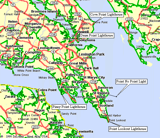