

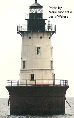
 Hooper
Island Lighthouse is one of only five lights constructed in the Bay during
the 1900's. The Hooper Island Lighthouse is located in approximately
18' of water, approximately three miles west of Hooperville, Upper Hooper
Island. It is a caisson style light, sunk 13.5 feet into the muddy bottom
of the Bay. It was first lit in 1902. The height of the light
above the water is 63 feet. The deck is about 18 feet above the water
level.
Hooper
Island Lighthouse is one of only five lights constructed in the Bay during
the 1900's. The Hooper Island Lighthouse is located in approximately
18' of water, approximately three miles west of Hooperville, Upper Hooper
Island. It is a caisson style light, sunk 13.5 feet into the muddy bottom
of the Bay. It was first lit in 1902. The height of the light
above the water is 63 feet. The deck is about 18 feet above the water
level.
There are four living levels, a watch room level and the lantern level. The interior of the tower is lined with white glazed brick.
The original 1902 lens was a fourth-order Fresnel manufactured by F. Babier & Company, Paris, in 1888. In 1904, the light was changed to a fixed white with an eclipse every 15 seconds. This light was automated in 1961 and the keepers removed. In 1976 the fourth-order fresnel was stolen and the Coast Guard replaced it with a solar optic.
The fog bell, manufactured by McShane of Baltimore in 1901, was changed to a Cunningham air diaphragm foghorn in the late 1930s. The fog bell was retained as a backup.
Of the eleven pneumatic caisson lighthouses built in the United States, seven were built in the Chesapeake Bay; three were built in the Virginia portion of Chesapeake Bay (Wolf Trap Lighthouse, 1894, Smith Point Lighthouse, 1897, and Thimble Shoal Lighthouse, 1914); and four in the Maryland portion of Chesapeake Bay (Solomons Lump Lighthouse, 1895, Hooper Island Lighthouse, 1902, Point No Point Lighthouse, 1905, and Baltimore Lighthouse, 1908). Hooper Island Lighthouse is the only cast-iron caisson lighthouse in Maryland with a watch room and lantern surmounted on the tower.

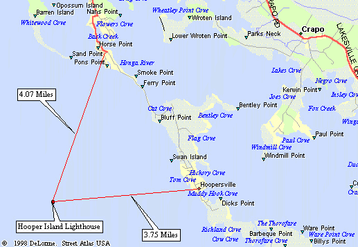
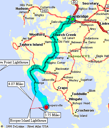
The closest that you can get to this light without a boat is about 3.75 miles. If you are going to drive to this viewing spot, make sure the weather is clear to be able to see the light. This drive should take about 50 minutes each way.
Crossing the Choptank River bridge into Cambridge, MD on the Eastern Shore of Maryland, continue through Cambridge, heading east untill you intersect with MD Route 16 on the right about 1 mile from the downtown.
Turn right onto State Route 16 and go about 7.6 miles until you come to State Route 335 on your left at the very small town of Church Creek.
Turn left onto State Route 335, (between the Post Office and the Fire Station).
Stay on State Route 335 for 10 miles until you come to a fork in the road at Gootee's Marina.
Turn right, staying on State Route 335 and go about 5 miles to Hoopers Island.
Once you reach the first island and after you pass a small store, a post office, and a small church located on an "S" turn, take the fiirst right hand turn.
Cross over a very large bridge for such a small island and you are now on Hooperville Island.
The light can be seen to the west about 3.75 miles off-shore from just about anywhere on the lsland.
Our thanks to Fots of Hooper Island for help with the driving directions.
| Large Area Map | Detailed Local Map | Driving Map |
| Some of these maps are large in size and may take a minute or two to load. | ||
 2001(c) Chesapeake Chapter, USLHS. All rights reserved.
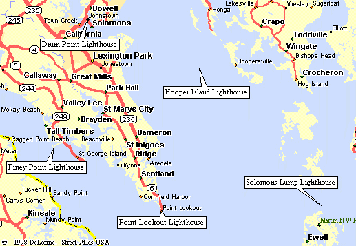