

 From I 95 NORTH toward Baltimore: Take Exit #49A which will be I 695 (Baltimore Beltway) East toward Glen Burnie/Key Bridge. Continue on I 695 East, which may become I 695 North before you leave the Beltway. (You WILL cross Key Bridge from this direction for which you should be prepared to pay toll.) Shortly after crossing the bridge, take Exit #43 which will be Bethlehem Blvd/MD 158/Peninsula Expy (MD 157) toward Sparrows Point. At end of ramp, turn Left. This will be Bethlehem Blvd. Continue on Bethlehem Boulevard Straight ahead through intersection with a traffic light (ignoring North Point BOULEVARD which you will cross). You will now be on North Point ROAD. Continue with "Craighill Front Common Directions" below.
From I 95 SOUTH toward Baltimore: Take I 695 (Baltimore Beltway) East (unnumbered exit) toward Beltway/Essex, which will become I 695 South toward Key Bridge/Sparrows Point before you leave the Beltway. (You will NOT cross Key Bridge from this direction.) Take Exit #42 which will be MD 151 South toward Sparrows Point. Stay Right at split on ramp. At end of ramp, turn Right. This is North Point BOULEVARD. Get IMMEDIATELY into Left lane and turn Left, at traffic light, on North Point ROAD (ignoring North Point BOULEVARD which will continue Straight ahead). Continue with "Craighill Front Common Directions" below.
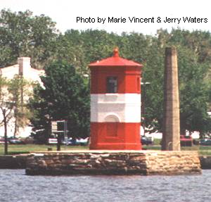
Craighill Front Common Directions: Continue on North Point ROAD all the way until it ends at the gates of the Fort Howard Veterans facility grounds and Fort Howard Park. At this point you will need to park your car nearby and sign in at the gate of the veterans facility and walk Straight ahead half a mile or so on Gettysburg Road to the closest view of the lighthouse by land. If, for any reason, you are not allowed onto the grounds of the veterans facility and Fort Howard Park is open, you can get the next closest land view. Just drive into the park, leave your car in the main parking area, and follow the path along the chain link fence a short distance not as far as the first fortification. The lighthouse will be visible through the fence, a relatively short distance away, across the veterans facility grounds. If both veterans facility grounds and park are inaccessible, return on North Point Road to Lodge Farm Road. Turning Left on it, follow Lodge Farm Road almost to its end. Turn Right on Bay Front Road. To the Left (especially through large gaps of open space) along this road, with the use of good binoculars, you can get various alternate views of this lighthouse from a greater distance. As you face directly out from the road, you will see it out near the mouth of Old Road Bay on the Left. Most of this area is, or may be, private property, even the open areas so please respect the rights of the property owners.
| Large Area Map | Detailed Local Map |
| Some of these maps are large in size and may take a minute or two to load. | |
 2001(c) Chesapeake Chapter, USLHS. All rights reserved.